If access to trails and open space is high on your wish list, Acton offers more variety than many buyers realize. Depending on where you land in town, living near conservation land can mean a wooded loop after dinner, a meadow walk on a quiet morning, or easy access to both trails and everyday amenities. If you are weighing neighborhoods in Acton, understanding how the town’s open-space network fits into daily life can help you choose the right setting for your next move. Let’s dive in.
Acton’s Open-Space Network
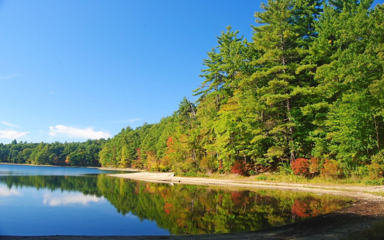
Acton has a notably strong conservation footprint for a suburban community. The town’s trail system is maintained by the Acton Land Stewardship Committee, which says it stewards more than 2,000 acres of conservation land, while the Conservation Commission describes stewardship of about 2,100 acres. You can explore the town’s official trail network through the Acton trails website, and the town also approved its 2024-2031 Open Space and Recreation Plan in December 2024, showing that open space remains a current planning priority.
That matters because trail access in Acton is not one single experience. The network includes woods, meadows, wetlands, ponds, stream crossings, farm fields, and a few places with recreation-focused uses. For you as a buyer, that means the feel of “living near trails” can vary quite a bit from one part of town to another.
Northeast Acton for Connected Trails
If you want the strongest trail-network story, northeast Acton stands out. This part of town includes Camp Acton, Spring Hill, Nashoba Brook, and Robbins Mill, with connector trails linking several parcels into a larger protected landscape.
According to the town’s trail pages, Spring Hill is the middle parcel in a protected area of more than 400 acres, and Nashoba Brook is one of four contiguous conservation lands totaling over 500 acres. Camp Acton also connects to Spring Hill, Nashoba Brook, and Robbins Mill, which makes this area especially appealing if you picture longer walks and multiple route options close to home.
Here is a quick look at several key areas in the north and northeast:
- Spring Hill: 2.5-mile loop on 213 acres off Pope Road, mostly level but stony, with the Bay Circuit Trail passing through.
- Nashoba Brook: 2.0-mile loop on 123 acres in North Acton, with variable terrain and some wet areas.
- Robbins Mill: 1.0-mile loop on 95 acres, mostly level with some stream crossings, bridges, and boardwalks.
- Camp Acton: 1.3-mile loop on 56 acres, and the town notes that it is the only Acton conservation land supporting picnicking or overnight camping.
- Wills Hole / Town Forest: 1.9-mile loop on 90 acres, with a glacial ridge and wetland or bog terrain.
If your ideal weekend includes a longer loop rather than a quick out-and-back, this part of town is worth a closer look.
Great Hill and South Acton Access
In central and south Acton, Great Hill is one of the clearest landmarks for buyers who want nearby trails. Great Hill sits between Kelley’s Corner and South Acton Center, covers 203.24 acres, and includes a hilly, rocky 2-mile loop plus a large open meadow behind the South Acton Fire Station.
This area offers a slightly different lifestyle picture than the larger trail cluster in the northeast. You still have meaningful trail access, but you also have a more mixed setting where conservation land, local centers, and transportation connections come together.
That is part of why South Acton often feels distinct within town planning. The town’s comprehensive plan describes South Acton as a mix of historic homes, small businesses, single-family homes, and some multifamily parcels, and current planning also points to denser multifamily housing within 0.5 miles of South Acton Station. If you want trail access paired with a more connected village setting, South Acton can be a compelling place to focus.
NARA Park Adds Recreation Options
While it is not a conservation parcel, NARA Park plays an important role in the lifestyle conversation. The town describes it as a 40-acre recreation hub with walking trails, a pond and beach, an amphitheater, and other programmed amenities.
For some buyers, that mix matters just as much as pure conservation land. You may prefer having both natural trails and recreation-oriented spaces nearby, especially if you want flexibility for different routines throughout the week.
West and East Acton Settings
West Acton and East Acton offer a different kind of trail experience. Instead of one large connected cluster, these areas are better understood as neighborhood-edge landscapes with their own character.
In West Acton, Guggins Brook Conservation Land is a lower-lying, frequently wet 61-acre parcel near West Acton Center and the Boxborough line. It connects to Jenks and to Boxborough via connector trails, while Jenks is described as a meadow landscape that was once part of Acton’s apple orchards.
On the East Acton and Route 2 side, Wetherbee includes farm field, meadow, marsh, and woodland across 73 acres. The research report also notes that Moritz Forest opened to the public in summer 2025 as a 33.11-acre woodland-and-wetland parcel that shares the Wetherbee trailhead.
If you are drawn to farm-field views, meadow edges, or a more rural feel, these parts of town may align well with what you have in mind.
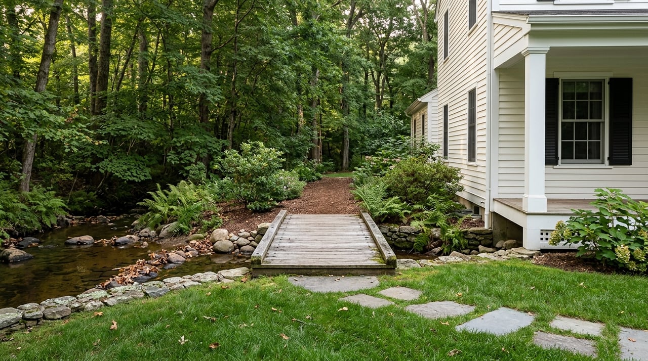
How Housing Varies Near Trails
One of the most helpful things to know is that Acton’s housing near conservation land is not all the same. The town’s three local historic districts are Acton Center, South Acton, and West Acton, so homes near trails may include older village houses and preserved streetscapes as well as more typical neighborhood settings.
The town’s comprehensive plan describes Acton Center as generally residential, West Acton as a commercial core surrounded by extensive neighborhoods, South Acton as a mix of historic homes, small businesses, single-family homes, and some multifamily parcels, and North Acton as a mix of commercial and light industrial uses plus single-family homes near NARA Park.
Townwide, single-family homes are the dominant residential type. The same plan says multifamily homes are concentrated mainly along Great Road, at Kelley’s Corner, and in parts of South Acton, with some additional multifamily in North Acton.
For buyers, this means your trail-access priorities can often be matched with different housing patterns:
- Northeast Acton: best fit for buyers focused on larger connected trail systems.
- South Acton: strong option if you want trails plus village context and proximity to the MBTA station.
- West Acton: good area to explore if you like neighborhood-edge conservation land and meadow or wetland settings.
- East Acton: appealing if you want a more field-and-woodland landscape near Route 2.
Daily Life Near Acton Trails
The strongest appeal of living near Acton’s conservation land is variety. The town’s trail geography supports short meadow walks, hillier woods loops, wetland paths, and longer connector hikes depending on where you live.
Acton also adds another layer through mobility connections. The town’s bike-share program lists stations along the Bruce Freeman Rail Trail at Brook Street and East Acton Village Green, plus a station adjacent to the Assabet River Rail Trail at South Acton MBTA Station.
Taken together, that makes Acton feel practical for everyday outdoor use, not just occasional weekend outings. You may find that living near trails here supports a more regular routine of walking, biking, and getting outside close to home.
Choosing the Right Part of Town
When you are deciding where to buy in Acton, the key is not simply asking whether a home is near trails. It is asking what kind of trail access fits your lifestyle.
Do you want a larger conservation network with multiple connectors? Northeast Acton may be the best place to start. Do you want a balance of trails, recreation, and village access? Great Hill and South Acton may deserve extra attention. Do you prefer meadow edges, wetlands, or farm-field surroundings? West and East Acton may be a better match.
That kind of neighborhood context can make a big difference when you are comparing homes that may look similar on paper. If you want help narrowing in on the right area of Acton for your goals, Ann Shaw Homes can help you evaluate trail access, neighborhood character, and the day-to-day feel of each setting with the benefit of deep local experience.
FAQs
What conservation land options are available in Acton?
- Acton’s official trail system includes more than 2,000 acres of conservation land, with settings that include woods, meadows, wetlands, ponds, stream crossings, and farm fields.
Which part of Acton has the most connected trails?
- Northeast Acton has the strongest concentration of connected conservation land, including Spring Hill, Nashoba Brook, Robbins Mill, and Camp Acton.
What is Great Hill in Acton like?
- Great Hill is a 203.24-acre conservation area between Kelley’s Corner and South Acton Center with a hilly, rocky 2-mile loop and a large open meadow.
How does South Acton compare for trail access?
- South Acton offers access to Great Hill and nearby recreation at NARA Park, along with a more mixed village setting near South Acton Station.
Are there different housing types near Acton trails?
- Yes. Areas near Acton’s trails include older village homes, primarily single-family neighborhoods, and some multifamily housing concentrated along Great Road, Kelley’s Corner, South Acton, and parts of North Acton.
Does Acton offer biking connections near trails?
- Yes. The town’s bike-share program includes stations along the Bruce Freeman Rail Trail and near the Assabet River Rail Trail at South Acton MBTA Station.